
Diploma - Geospatial Expert

Course
Online
*Indicative price
Original amount in USD:
$ 150 $ 645

-

John Academy
Course Online£ 28 £ 247 -
One Education
Course Online£ 9 £ 425 -
George Washington University
Course Online£ 100 -
Great Plains College
Course OnlinePrice on request -
IMF Business School - Portugal
Postgraduate OnlinePrice on request -
Oxford Learning College
GCSE Online£ 267 -
City College Norwich
BTEC OnlinePrice on request


Your training makes the difference
-
Type
Intensive workshop
-
Level
Advanced
-
Methodology
Online
-
Duration
1 Year
-
Start date
Different dates available
-
Online campus
Yes
-
Virtual classes
Yes
Would you like to advance your professional career? Are you looking for specialized training and make a difference through your training? You have come to the right place, Emagister presents the program Diploma - Geospatial Expert taught by AulaGEO Academy.
This course is aimed at users interested in the field of Geographic Information Systems, who want to learn the tools and methods in a comprehensive way. Likewise, to those who wish to complement their knowledge, because they partially master a software and wish to learn to integrate geospatial information in its different cycles of acquisition, analysis and provision of results for other platforms.
Therefore, we encourage you to request more information, through the button attached to this website, in this way an advisor from the center will contact you to answer any questions.
Facilities
Location
Start date
Start date
About this course
- Create capabilities for the acquisition, analysis and disposition of geographic data.
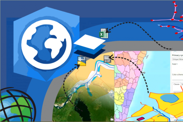
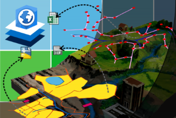
- This course includes learning ArcGIS Pro and QGIS, the most widely used programs in the field of geospatial data; as well as the use of tools with which information is interoperated in other disciplines such as Blender and Google Earth.
- Additionally, it includes modules to learn how to prepare results to publish on the Internet.
- Developers
- GIS and Geospatial Users
- Data researchers
- Everyone who wants to improve their profile and expand their opportunities in geospatial design and analysis.
- GIS users which have used ArcGIS Desktop versions and want to learn how to do the process with ArcGIS Pro
- Enthusiasts and users of Geographic Information Systems
- The course is from scratch. So it can be taken by a geo-engineering professional or a design enthusiast.
- Basic math skills
- Basic to intermediate Python skills
With this diploma, the necessary skills are acquired to process, transform and present spatial data in a coherent and simple way.
Also, It is a different diploma because it is divided into 6 courses for better assimilation and interaction with the contents. The courses are the following shown here:
You will be given all the necessary information regarding the diploma. You can also contact the AulaGEO team for any additional information. For more information visit our website https://www.geofumadas.com/diplomados-aulageo/
Reviews
This centre's achievements
All courses are up to date
The average rating is higher than 3.7
More than 50 reviews in the last 12 months
This centre has featured on Emagister for 6 years
Subjects
- Remote Sensing
- ArcGIS
- QGIS
- WebGIS
- Python
- Plotty
- Data science
- Satellite images
- Cartography
- LiDAR data analysis
- Learn Data Science
- Learn GIS
- GIS
- Blender modeling
- PostGIS
- Geoserver
- Openlayers
- OpenStreetmap
- ArcGIS Online
- Imagery analysis
Teachers and trainers (1)

AulaGEO Academy
Specialized center in Geospatial, Engineering and Operations
We choose the best courses and make them available to new audiences in the spectrum CAD - GIS - BIM - Digital Twins Our training offer covers the entire spectrum of data intelligence: Capture - Modeling - Design - Construction - Operation. The creators of courses with which we have decided to work or promote have been carefully selected, to offer a complementary set of knowledge. We firmly believe that today people do not seek courses to fill their walls with diplomas; but to make their abilities more productive.
Course programme
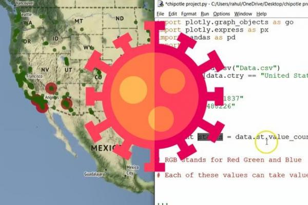
1. Data Science Course - Learn with Python, Plotly and LeafletThis is a course for lovers of data visualization. It has been elaborated with practical exercises of the current context for its better understanding and application in 10 intensive hours. What you will learn:
- Introduction to data visualization
- Data types and chart types
- Data visualization in Plotly
- COVID display on Plotly
- Plot geographic data on plot
- John's Anger Chart
- Scientific and statistical graphics and animation
- Interactive maps with brochure
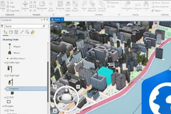
2. ArcGIS Pro course - basic. It is a course designed for GIS enthusiasts who want to learn how to use this Esri software, or users of previous versions who hope to update their knowledge in a practical way. What you will learn:You will learn to create thematic symbology based on attributes, import data from Excel, analysis of buffers and image georeference.
- You will learn to share data and understand how final maps are generated.
- The course includes step-by-step guided exercises applied in the AulaGEO environment.
- Learn how to use the ArGIS Pro software.
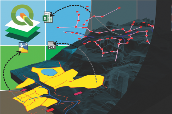
Geographic Information Systems using QGIS. What you will learn:
- All the exercises you can do in ArcGIS Pro, done with free software.
- Import data from CAD to GIS
- Attribute-based theming
- Rule-based calculations
- Print Layout
- Import coordinates from Excel
- Digitization tricks
- Georeference images
3. Advanced ArcGIS Pro CourseThis course includes the advanced aspects of ArcGIS Pro. What you will learn:
- Management of satellite images (Imagery),
- Spatial databases (Geodatabse),
- LiDAR point cloud management,
- Content publishing with ArcGIS Online,
- Applications for mobile capture and visualization (Appstudio),
- Creation of interactive content (Story maps),
- Creation of final content (Layouts).
4. Blender course - City and landscape modelingWith this course, students will learn to use all the tools to model objects in 3D, through Blender. One of the best free and open source multiplatform programs, created for modeling, rendering, animation and 3D data generation. What you will learn:
- Blender modeling
- Import data from OpenStreetMap to Blender
- Modeling cities and surfaces in Blender
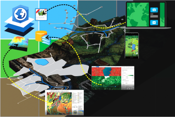
5. WebGIS course with open source software and ArcPy for ArcGIS ProThis course focused on the development and interaction of spatial data for the implementation of the Internet. For this, three free code tools will be used: PostgreSQL, for data management, GeoServer, for stylizing data, OpenLayers, for web implementation, as well as Python Programming in ArcGIS Pro. What you will learn:
- Develop web content using open source
- Geoserver: installation, configuration and interaction with open layers
- PostGIS - installation and interaction with geoserver
- Open layers: reception using code
6. ArcGIS 3D
Additional information
Diploma - Geospatial Expert
*Indicative price
Original amount in USD:
$ 150 $ 645
-
John Academy
Course Online£ 28 £ 247 -
One Education
Course Online£ 9 £ 425 -
George Washington University
Course Online£ 100 -
Great Plains College
Course OnlinePrice on request -
IMF Business School - Portugal
Postgraduate OnlinePrice on request -
Oxford Learning College
GCSE Online£ 267 -
City College Norwich
BTEC OnlinePrice on request