ArcGIS 10 step by step from scratch
-
It is very explanatory and easy steps to follow. thanks
← | →
-
So far it is very well explained
← | →
-
In general it is a course that starts from scratch, until reaching an intermediate level. Thank you for translating the course.
← | →
Training
Online

Learn with us!
-
Type
Training
-
Methodology
Online
-
Class hours
4h
-
Start date
Different dates available
Do you like GIS? Emagister presents ArcGIS 10 from scratch and get a certificate.
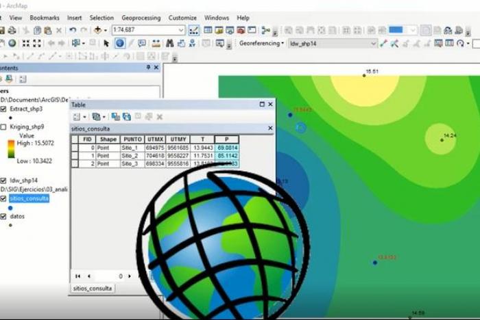
Geographic Information Systems ArcGIS‑10 course is 100% prepared by the creator of "El blog de franz - GeoGeek", if you have visited that page you will know that if you are going to learn, do it before starting.
Includes exercises while most of it is practical, step by step. It also combines a theoretical part that allows students to base their knowledge on GIS, because it is not intended to impart mechanized learning, but integral. Include basic tasks like:
-Georeference with control points
-Georeference a Google Earth images And advanced like
-Calculate the Normalized Difference Vegetation Index (NDVI)
-3D flood simulation in ArcGIS
-Create a map of isoyetas and isotherms in ArcGIS
-Download satellite images from Google Maps, Bing, etc.
Do you want to know more details about this course? Contact us through Emagister.co.uk!
Facilities
Location
Start date
Start date
About this course
"ArcGIS 10 from zero to intermediate level.Understand basic concepts of GIS.Georeference images.Create and manage shapefiles.Use geoprocessing tools.Calculation of geometries (area, perimeter, length, etc.).Management and administration of tables.Develop skills in spatial analysis.Know the main tools of Spatial Analyst.Apply different types of symbology.Know the interpolation and its applications.Design maps ready for printing."
"GIS world lovers.Professionals in forestry, environmental, civil, geography, geology, architecture, urban planning, tourism, agriculture, biology and all those involved in Earth Sciences.People who want to know the potential of ArcGIS."
"Basic notions of cartography and geodesy.ArcGIS 10 (in English) installed on your computer"
"-100% online -Access to the course for life -30 days warranty money back -Available from desktop or mobile app -Can begin and finish the course any time -Can repeat the course any times"
Reviews
-
It is very explanatory and easy steps to follow. thanks
← | →
-
So far it is very well explained
← | →
-
In general it is a course that starts from scratch, until reaching an intermediate level. Thank you for translating the course.
← | →
Course rating
Recommended
Centre rating
MOSHOOD AKEEM OLAYINKA
Ludwig PC
Franz Pucha Cofrep
Hamza A
Shaikh Tojibul Islam
Sheela Rao
This centre's achievements
All courses are up to date
The average rating is higher than 3.7
More than 50 reviews in the last 12 months
This centre has featured on Emagister for 3 years
Subjects
- Satellite
- ArcGIS
- Cartography
- Topography
- Simulation
- 3d training
- 3D
- GIS
- Google Earth
- Geoprocessing tools
- Spatial analysis
- Georreference images
- Design maps
- Landsat
- NDVI
- map
- Geographic
- Earth
- Clippings
Teachers and trainers (1)

AulaGEO Academy
Specialized center in Geospatial, Engineering and Operations
We choose the best courses and make them available to new audiences in the spectrum CAD - GIS - BIM - Digital Twins Our training offer covers the entire spectrum of data intelligence: Capture - Modeling - Design - Construction - Operation. The creators of courses with which we have decided to work or promote have been carefully selected, to offer a complementary set of knowledge. We firmly believe that today people do not seek courses to fill their walls with diplomas; but to make their abilities more productive.
Course programme
Starting with ArcGIS
Georeferencing
Georeference with control points
Georeference without control points
Georeference a Google Earth image
Generation of vector entities
Shapefiles creation
Shapefiles edition
Working with points
Working with lines
Working with polygons
Define projection to a layer
Project a layer to another reference system
Table Administration
Working with tables: Create new fields
Working with tables: Enter information to tables
Area, perimeter, and length calculation
XY coordinate calculation
Operations
Geoprocessing tools
Area of influence (Buffer)
Intersections (Intersect)
Clippings
Merge
Dissolve
Conversion between shapefiles
Spatial analysis
Add XY coordinates and export them as shapefile
Interpolations
Extract values from a raster from coordinates
Creation of slope maps
Reclassifications
Contour Generation
Maps Algebra
Design and publication
Categorization of vector layers
Symbology of points, lines and polygons
Add topographic effect
Map Design
Insert title
Map body
Insert grid or grid
Insert the North arrow
Add location map
Insert legend
Add numerical scale
Add graphic scale
Geodetic Reference Parameters
Module detail area
Organize map elements
Export and print a map
Bonus: Extra lessons
3D flood simulation in ArcGIS
Create a map of isoyetas and isotherms in ArcGIS
Label contour lines
Extract values from a raster to a table
Model Builder: Iterators tables
Model Builder: Feature Selecction
Edit polygons in ArcMap
Download satellite images from Google Maps, Bing, etc.
Operations with Field Calculator
Working with Landsat 8 images
Download Landsat 8 images
Calculate the Normalized Difference Vegetation Index (NDVI)
Calculate the surface temperature of the earth with satellite images"
ArcGIS 10 step by step from scratch
